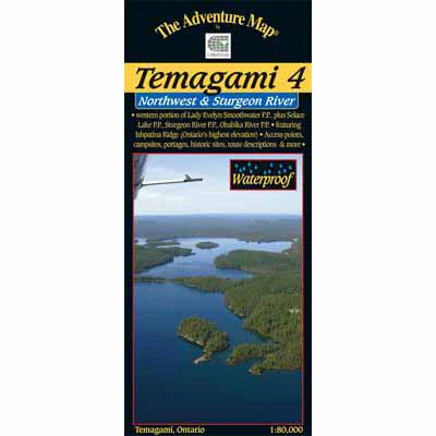
Temagami 4 - Northwest & Sturgeon River
This map shows the more remote western side of classic Temagami; the ideal area for a fly-in trip or a lengthy multi-week route. In addition to a selection of paddling routes through large and small lakes, there are several great river routes, and even the chance to hike to the highest elevation in Ontario, Ishpatina Peak.
It is a large map showing all or parts of 5 Provincial Parks as well as several Conservation Reserves that border and help protect them. The largest Park is Lady Evelyn-Smoothwater, the eastern portion of which is found on our Temagami 1-Northeast map. LES includes Maple Mountain (another provincial high point) and the afore-mentioned Ishpatina, as well as several large lakes and strings of lakes, plus a whitewater gem, the Lady Evelyn River.
Solace Provincial Park covers an unusual collection of string lakes in probably the most remote part of the area that provides a connection between Florence Lake and the Sturgeon River.
Sturgeon River Provincial Park Is a lengthy, wild river-paddle south through both flat and whitewater sections. The current is slow enough that one can also paddle upstream in parts, making for some interesting route choices. We show it all the way south from Stull Lake area near Ishpatina Peak to the junction with Wawiashkashi Lake.
Obabika River Provincial Park is a meandering river-great for wildlife viewing-that connects the eastern part of Temagami and Obabika Lake to the Sturgeon River.
You'll also find and inset of Makobe-Grays Provincial Park which follows the Makobe River north from Banks and Makobe lakes to the small Town of Elk Lake on the Montreal River.
Original: $9.50
-70%$9.50
$2.85Description
This map shows the more remote western side of classic Temagami; the ideal area for a fly-in trip or a lengthy multi-week route. In addition to a selection of paddling routes through large and small lakes, there are several great river routes, and even the chance to hike to the highest elevation in Ontario, Ishpatina Peak.
It is a large map showing all or parts of 5 Provincial Parks as well as several Conservation Reserves that border and help protect them. The largest Park is Lady Evelyn-Smoothwater, the eastern portion of which is found on our Temagami 1-Northeast map. LES includes Maple Mountain (another provincial high point) and the afore-mentioned Ishpatina, as well as several large lakes and strings of lakes, plus a whitewater gem, the Lady Evelyn River.
Solace Provincial Park covers an unusual collection of string lakes in probably the most remote part of the area that provides a connection between Florence Lake and the Sturgeon River.
Sturgeon River Provincial Park Is a lengthy, wild river-paddle south through both flat and whitewater sections. The current is slow enough that one can also paddle upstream in parts, making for some interesting route choices. We show it all the way south from Stull Lake area near Ishpatina Peak to the junction with Wawiashkashi Lake.
Obabika River Provincial Park is a meandering river-great for wildlife viewing-that connects the eastern part of Temagami and Obabika Lake to the Sturgeon River.
You'll also find and inset of Makobe-Grays Provincial Park which follows the Makobe River north from Banks and Makobe lakes to the small Town of Elk Lake on the Montreal River.